
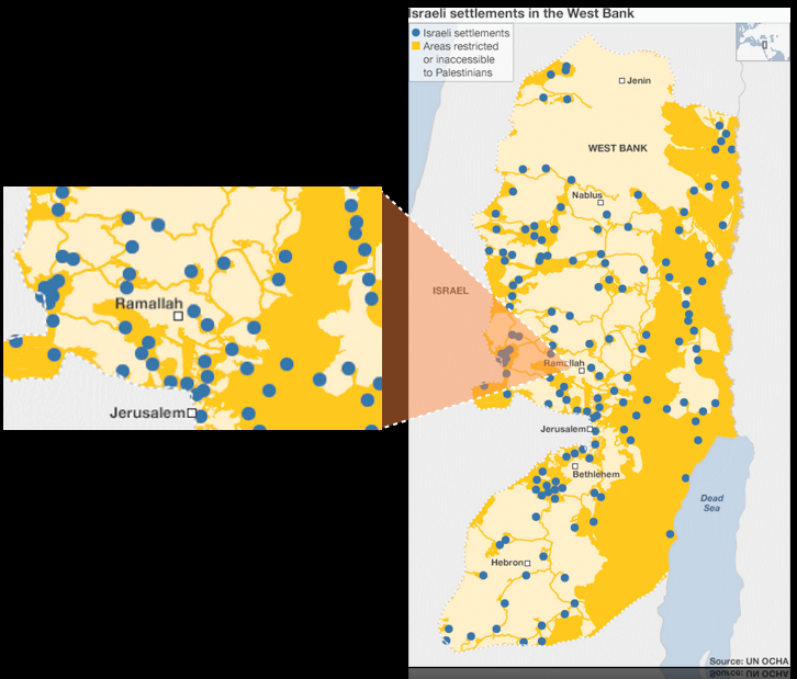
The map below shows the West Bank (the area marked "Palestine" in the third map section above). The dark yellow areas are those restricted or inaccessible to Palestinians, and the blue dots are illegal Israeli settlements. Dark yellow lines show segregated Israeli-only roads linking settlements. OCHA map (UN Office for the Coordination of the Humanitarian Affairs).
“How would you feel if the UN had decided to create the state of Israel within the U.S. instead of in Palestine in 1947?”
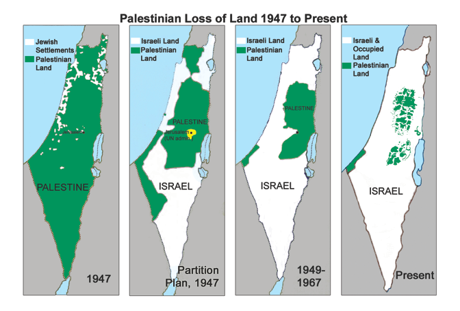
The UN allocated 55% of the land to the Israeli state, even though the Jewish population owned less than 7%. Within the next year, most of the Palestinians living on the land for the Israeli state had been driven out, and Israel had taken over half the land for the Palestinian state, driving Palestinians off that land too. None of these Palestinian refugees were ever allowed to return to their homes. The expulsion of the Palestinians in 1948 has never been resolved.
